
Our plan for departing Chiloe Island was to take the ferry eastward across the sound to Chaiten, nestled at the base of the Andeans. The hostel owner was quite certain we'd find the ferry leaving at noon from Quellon, a couple hours' bus ride to the south.
Quellon is most notable for being the southern terminus of "The 5" freeway, which starts in Fairbanks, Alaska, so we decided we´d go that way. The other option was to hop 30 minutes north to the central town of Castro, where our hostel owner predicted a similar ferry would leave at 4:00 p.m. (He assured us that, if he was wrong about the Quellon boat, or if it happened to be full, we'd have a second chance in Castro.)
"Best laid plans..."
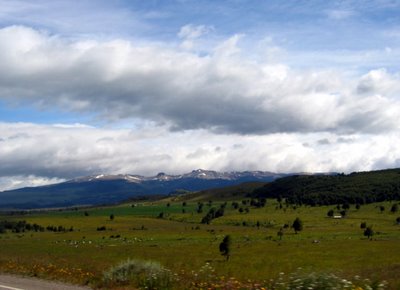
After a lovely bus ride to the end of the 5 "freeway" (photo below; click on it for enlarged view -- you'll need that to be able to see it), we found the ferry service office closed and locked. Helpful locals informed us we could easily catch the next boat if we just waited ... for four days!!! Furthermore, they were quite sure there was no boat from Castro!

Hmm... Time to regroup. Having left our hostel before breakfasttime, we decided brain and body needed nourishment before tackling this little problem. We finally did find a place to get some sort of breakfast, but our explorations of the town during the search were not encouraging. Four days in this town looked to be an adventure we'd rather avoid.
After breakfast, I (Case) decided to amble down to the town's information kiosk, which the guide book assured us would be open 9-to-9 in the summer (now).
Closed!
On the faintest of hopes -- this being a weekend day -- I re-checked the ferry office. Huzzah! It was now open, and staffed by reasonably knowledgeable people. They were happy to inform me that, while there was indeed no ferry from here until Wednesday, the Castro ferry would depart in just 20 minutes. (Not, as we had been led to believe, at 4 p.m.) All I needed was a supersonic jet standing by outside, and we would surely make it!
They then handed me a lovely "glossy" detailing the summer ferry schedule. This was the document (and information) which they had neglected to disseminate to travel agents or their web site, thereby enabling the fine mess we were now in! They did, however, helpfully suggest the next day's boat from Castro and assured me that we'd have no problem securing passage.

Quellon having quelled our interest, we hopped a bus back to the north. A night in Castro didn't especially interest us, and we weren't about to take our custom back to the misinformed hostel owner, so we decided to visit Ancud, a fishing hamlet on the northern tip of the island. This was a happy choice, and led to a relaxing afternoon in that town and a relatively restful night in a unique little hotel there. (The only drawback was that, it being Saturday night and the hotel being on the town square, I was wakened several times by the sound of ongoing festivities. These simple fisherfolk do know how to party on their weekends! Maybe that's why Mass doesn't start until 11 or noon...)
Arriving back in Castro the next day, we tried the ferry office. Closed! After some consternation, a helpful passerby explained that we were 5 hours early for the sailing, so the office wasn't open yet. So off we went for lunch, returning one and a half hours of the scheduled sailing time to find the place open and a family of 5 just completing their ticket purchase.

I cheerfully approached the agent, asked for two tickets, and whipped out my wallet. "Sorry, sir. The boat is full." (I couldn't tell for sure, but I hope his Spanish was that courteous.) Huh? Really? Oh, no! I spent a rather uncharitable moment wishing we'd arrived five minutes before the family of 5, instead of five minutes after.
The ticket agent did have alternatives for us -- he suggested we hop on the bus, backtrack five hours to Puerto Montt, stay overnight, and catch
tomorrow's ferry from there! At this point, I felt it might be time to press the issue just a bit. Was there no possibility that some ticket-holders might fail to show? Was the ferry full at the last stop? Might he believe that my wife was 11 months pregnant and needed to get to her doctor in Chaiten? Might I suggest that I was on official business investigating a murder (his, if he didn't get me on that ferry!!!)? Would he believe I was running for president? Perhaps I could clean the toilets? I begged. I pleaded. I enlisted the aid of other passengers.
"Wait", we were told. No need -- we were already hunkered down, prepared to camp in front of his desk until the last line was cast off and the ferry departed along with our last hopes of boarding. Minutes passed. There were phone calls and visits by nautically-dressed gents who engaged in lengthy conversation. The other passengers (who understood the interchanges I could not follow) began to nod and encourage us. "It'll work out."
At length, I was summoned to the agent's desk, asked for our names, and handed our tickets without fuss, ceremony, or even a "OK, buddy, you own me on this one." Whoopee! I paid up and we left before they could change their minds.

Here we are aboard, all smiles after our 36 hour search to find and board the ferry!
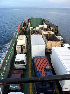
It's was a long-ish ride (8 hours) on a ferry that serves many purposes beyond passenger transport.
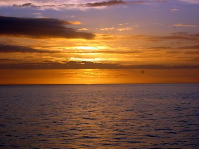
The cabin was a bit stuffy, and we hadn't paid for seats, so we stayed outside as long as the cooling evening would allow. That also enabled us to enjoy this truly fantastic sunset.

As the sunset faded, we caught its last light on the volcanic peak ahead, on the mainland to which we were headed...


 We found these berries carpeting the ground in several areas of the park. We hear that, if you eat them, you are sure to return to Patagonia. We only ate jam made from them. So does that me we´ll jam in another trip sometime???

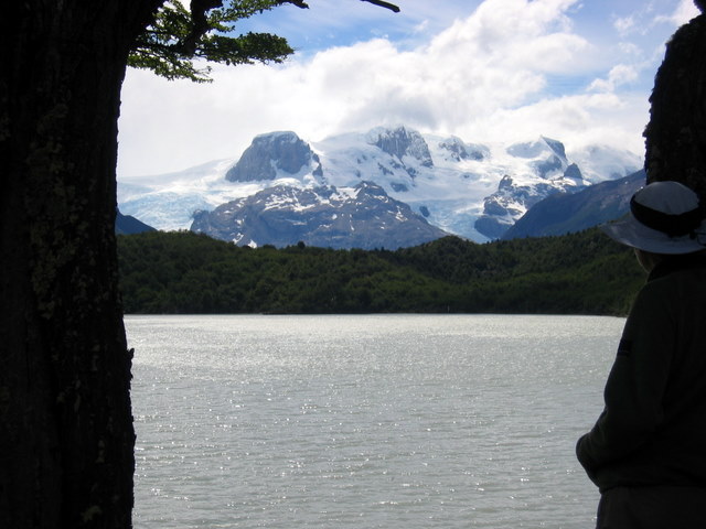


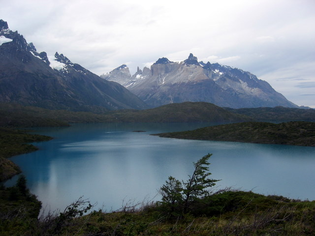

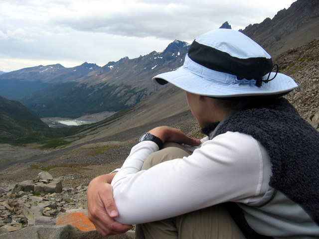
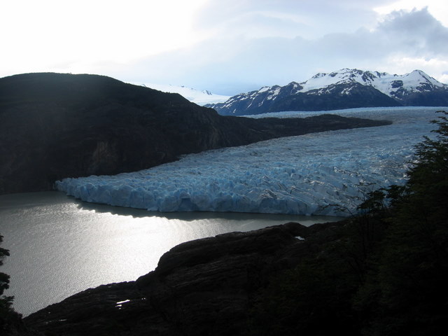
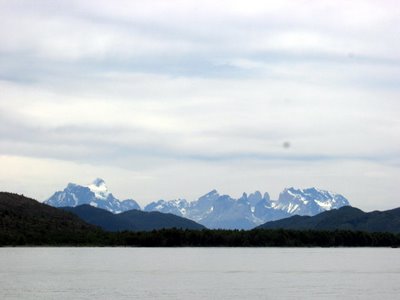
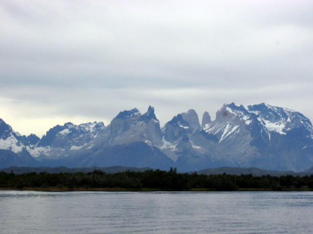
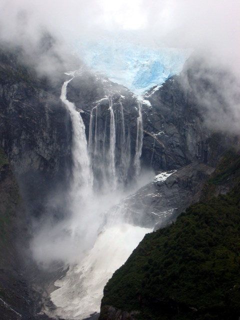
 Despite this long-contemplated goal, I´m not sure I could tell you what TDP actually is, aside from a small range of spectacular glaciated mountains that can be circumnavigated in a 100-120 km. hike. National Geographic said they´re one of the world´s most spectacular wilderness areas. That and a few photos and trip accounts we reviewed on line were good enough for us.
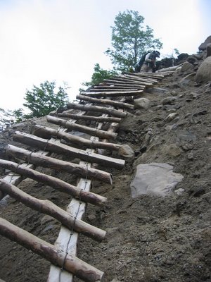
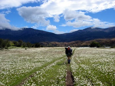
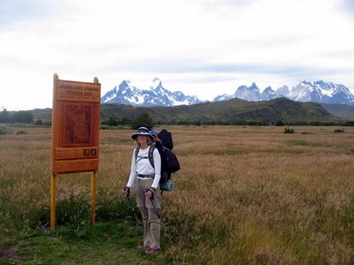 Finally, at about 5 p.m., we loaded up or packs and headed out on the trail into the long summer evening.


